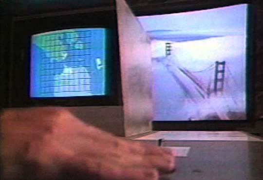
For the Golden Gate Fly-Over, it is productive to reevaluate its concept in alternative point view. Functioning more in the sense of geographical navigation, precise grid not only helps to orientate but also locate precisely. The unnaturally fast speed when people move around the trackball to navigate the Bay Area of S. F. tends to be offering an Omni-view on the area that is covered with pre-recorded footage. Since it is geographically oriented, the slight difference of time is reasonably omitted. Pushing these two a little further, if a story there during a period of time is to be told, how to reach the narrative requirement of telling a story with time axis added while still keep the spatiality? Directing to this function, some of the grids where nothing happens might mostly be omitted for footage so the narrative would be economic. Compelling shots might be realized by placing the camera lower other than a bird’s view.
Function of the pre-recorded footage is not a limited. “Limits to how we communicate limits what we communicate”. This is so inspiring to think how limited it might be for cinematic storytelling to be interactive and how to play with the limit where elements of time, space, event and physical input/interface come to together.
Golden Gate Fly-over is a moviemap of the San Francisco Bay Area from the air made the Exploratorium. We used a special gyro-stabilized helicopter camera and satellite navigation to film along a precise ten by ten mile grid centered on Golden Gate Bridge. This exhibit uses a single trackball as the input device, so it is very easy to use. It allows moving around the Bay Area at unnaturally fast speeds. The goal was not to re-create a helicopter ride as much as to create a hyper-real experience, something impossible to experience in the physical world.
Source: http://www.naimark.net/projects/goldengate.html
http://interactive.usc.edu/thesis2007/papers/multicam_narrative/the_chosen.pdf

